I grew up on a stretch of road between the vineyard-laden towns of Bethany and Tanunda in South Australia’s renowned Barossa Valley.
At the end of that street, I would pass a little red arrow affixed to a fence post, pointing me away from the valley floor and up into the distant Barossa Ranges. This mystery marker caused me perpetual confusion as nothing of any great interest lay within ‘walking distance’ of the intersection.
It wasn’t until an excursion to Hans Heysen’s family home ‘The Cedars’, and an explanation of his legacy, that I ultimately realised that I lived alongside one of Australia’s longest hiking tracks, the Heysen Trail. Since that day, the iconic route has filled me with curiosity and intrigue, and I’ve realised that anywhere worth seeing is within ‘walking distance’.
Fast-forward two decades and my life was about to change for the more nomadically inclined. After almost seven years locked away in an office, I had decided to up-and-leave my cushy 9-5 desk job as a studio-based designer, copywriter and photographer. It was time to start exploring. This early-life crisis uprooted me from the cosy comforts of home and spat me out into Australia’s boundless wide-open spaces.
Over the next year, I visited bustling cities, quaint rural towns and the country’s abundance of extraordinary natural marvels. However, despite all I’d experienced, one particularly long, sentimental journey remained; it was time to go home. After two decades of passive contemplation, an adventure along the Heysen Trail beckoned.
I began my journey from the northern trailhead on August 13, 2018, and didn’t look back — except to find where I left my hiking poles.
The Heysen Trail
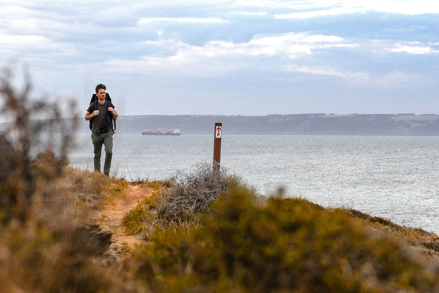
There may be no better snapshot of South Australia’s natural diversity than the winding route of the 1,200-kilometre Heysen Trail. This epic long-distance trek transverses rocky coastal landscapes, untouched bushland, pristine National Parks, soaring pine forests, sweeping pastoral districts and, of course, the state’s famous Barossa Valley vineyards.
Recognised internationally as one of the world’s most exceptional long-distance hiking trails, the Heysen Trail remains the longest marked walking trail in Australia. Traditionally running from south to north, I reversed my hike, setting off from the rugged Parachilna Gorge Trailhead and finishing on the Southern Fleurieu coastline two months later.
For more information on the Trail’s history, maintenance, news, memberships and walking programmes check out The Friends of the Heysen Trail online.
Follow my journey: Heysen Trail Daily Diaries
Overview
Heysen Trail Details (2020)
Distance: 1,103 kilometres (approx. 1,200 kilometres including spurs)
Time: 45-60 days
Dates: Open April-November (outside of Fire Danger Season)
Trail Towns: 18
Trail Campsites/Huts: 55
Traditional Owners: 7
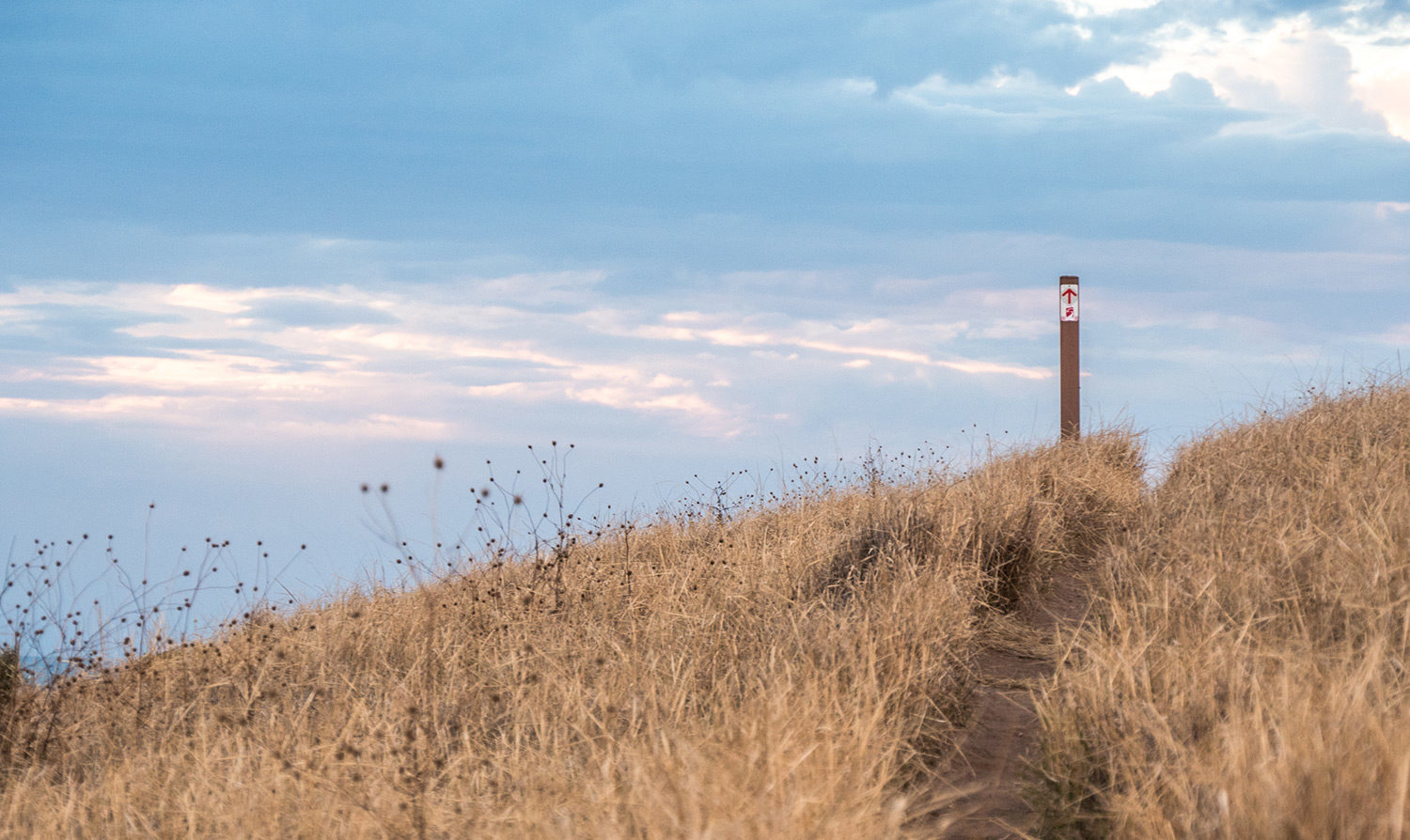
What to expect on the Heysen TrailBe under no illusions, the Heysen Trail is not an all-conveniences supplied stroll in the park. A majority of the hike is graded within classes 4-5 of the Australian Walking Tracks Classification. So, not easy going. And, if for no other reason than to illustrate my point, once you have completed the Trail, end to end, you will have climbed 22,755 metres or the equivalent of Mount Everest 2.56 times! As you might imagine on a track that weaves 1,200 kilometres through a series of public and privately owned lands, the Heysen Trail is exceptionally diverse. In fact, it’s arguably the most diverse trail in the whole country. The terrain, too, is highly varied, covering pulsating ranges in the north, flat flourishing farmland in the middle and wild coastal regions in the south. The climate fluctuates heavily throughout the length of the Heysen Trail; from blustery, foggy winters at the southern end to unforgivingly inhospitable summers in the north. If you’re planning on hiking the entirety of the 1,200-kilometre journey, you must be prepared for all conditions. With any luck, you will experience the full array of South Australia’s native wildlife, including koalas, kangaroos, echidnas, emus, goannas, lizards, seals, dolphins, whales and the state’s extraordinary array of endemic birdlife. Though, as always on treks through Australian bushland, walkers should be prepared for snake sightings. I only saw one for my entire trip; that was enough for me. |
There is an infinity of landscape here, caused by the purity of the atmosphere.
Hans Heysen
The best time to hike the Heysen Trail
South > North (Cape Jervis to Parachilna Gorge)
April/May to June/July. To make the most of the conditions, begin the Trail in the milder Autumn months of the south and arrive in the moderately temperate winter of the hotter mid-north. This direction helps hikers ease into their routine as the tracks are often flatter and easier to navigate than the northern end.
North > South (Parachilna Gorge to Cape Jervis)
August/September to October/November. Departing from Parachilna Gorge near the end of winter gives the Trail’s rainwater tanks the best chance of filling before you arrive. On top of this, the sun is at your back, the weather is ideal and you will arrive in Adelaide’s Conservation Parks with spring’s wildflowers in bloom.
Why did I walk the Heysen Trail?
Apart from the obvious nostalgic reasons, there was one fundamental reason I wanted to push my limits on the Heysen Trail. I wanted to make my walk bigger than myself and give back to the wider community. So, it was with enormous pride that I raised funds for the Black Dog Institute and awareness for mental health issues while on my journey.
Completing the trek was easily my most demanding physical and mental challenge. However, I knew this isolated two-month battle was nothing compared to the struggles that people suffering from mental health issues go through every day. What I didn’t expect was the outpouring of, not only, support, but heart-wrenching accounts, from close mates and total strangers. The more I spoke to people, the more I discovered how widespread depression, anxiety and the many other forms of mental health issues affect everyday people around the world.
The Heysen Trail traverses some of South Australia’s most spectacular rural landscapes; many of which are situated in remote regions, far from major cities with their much-needed medical support. In 2018, Australia was in the middle of one of our driest winters on record. Apart from the obvious financial and environmental toll, the drought also has a mental and emotional impact on our country regions. There may be no better time to talk about mental health issues than right now. Increasing the support and awareness for mental health, particularly in rural communities, is essential to its wellbeing.

October 2, 2018
Hi Josh. I hope you’re well. I stalked your insta and you’re making great time. I could pick your brain for hours about this trek so please contact me when you have a chance. I’d appreciate it tremendously! I wanna talk gear, logistics, stats, everything lol! Hope to hear from you. I know you’ll be busy putting together your doco but whenever you end up procrastinating, let me know haha.
October 6, 2018
Hey Kellz! Please, pick away! I’ve still got a handful of days left until I finish the trail, but feel free to flick across any questions you might have, otherwise, we can catch up for a beer if you’re kicking around the Adelaide area in the next few weeks? The plan is to flesh out all the details, stats and imagery from the walk on the blog over the next month, so that might tick off a few of the questions you have lined up.
June 27, 2020
Hello
I m lookin at walking the Heysen during August September 2020.i was lookin at startin from cape jet is however after reading ur comments I may start from the northwot I m really interested to know is wot emergency communications device h would recommend (PBL)I m an experienced long distance walker however have not had one beforelook forward to hearing ur thoughts
Cheers
Sandra…
July 1, 2020
Hi Sandra,
Yes, if you’re starting in August, I’d recommend heading north to south – the weather should be much nicer. I’d absolutely also recommend taking a PLB. If you’re intending to hike more remote areas, I’d suggest looking into buying one from an outdoors or fishing store, but if you’re only using it just this once, I hired one from http://www.adventurentals.com/safety.html who do good deals for Heysen Trail long-distance hikers.
There’s also a Facebook group called Heysen Trail E2E Through Hiking https://www.facebook.com/groups/1284588645043255/ which is great for sharing general and up-to-date information.
Hope this helps!
March 27, 2022
My wife and I are planning to walk from Parachilla Gorge Gorge to Aroona on April 16 2022
Is this path easy to follow?
Is it well marked?
It is 18.3 km. We will be walking at 3 km an hour. Plus we will need rest. This will be a 8 hour day.
Is there mobile phone coverage along this section?
Does an officer from the National Parks and Wildlife Service visit this section of the path before it is open? I would like a definite understanding of the water supply at Aroona.
May 17, 2022
Hi David, I trust you received my response via email. I hope you had a great trip! It’s a beautiful part of the world.
February 5, 2023
Hey Josh,
How difficult is the trail on foot? Any technical climbs that can’t be done on a bike? I was thinking of incorporating this trail into my Melbourne to Adelaide bike touring journey.
Also, is wild/dispersed camping allowed in SA on parts of this trail?
Thanks mate
February 6, 2023
Hey Levi,
Unfortunately, the HT includes regular fences/stiles that need climbing (paaaainful for cyclists). However, the Heysen has a ‘sister’ trail that basically shadows the same route – the Mawson Trail https://www.southaustraliantrails.com/trails/mawson-trail/
And, it’s best policy to stick to the designated campsites, particularly as they’re often the only places you can refill water. But, if you run into issues, most locals are understanding.
Hope this has helped!
February 6, 2023
Thanks for your informative reply, Josh. I’ll pin The Mawson Trail to my tour.